 국립중앙도서관 "우편 복사 서비스"로 연결 됩니다.



 DBpia

Examined in this article is how the borderline between Koguryo and Baekje changed during the latter half of the 4th century and the early days of the 5th. Examination shows us that both dynasties competed with each other during the 370s and the 380s, ...
다국어 입력
あ
ぁ
か
が
さ
ざ
た
だ
な
は
ば
ぱ
ま
や
ゃ
ら
わ
ゎ
ん
い
ぃ
き
ぎ
し
じ
ち
ぢ
に
ひ
び
ぴ
み
り
う
ぅ
く
ぐ
す
ず
つ
づ
っ
ぬ
ふ
ぶ
ぷ
む
ゆ
ゅ
る
え
ぇ
け
げ
せ
ぜ
て
で
ね
へ
べ
ぺ
め
れ
お
ぉ
こ
ご
そ
ぞ
と
ど
の
ほ
ぼ
ぽ
も
よ
ょ
ろ
を
ア
ァ
カ
サ
ザ
タ
ダ
ナ
ハ
バ
パ
マ
ヤ
ャ
ラ
ワ
ヮ
ン
イ
ィ
キ
ギ
シ
ジ
チ
ヂ
ニ
ヒ
ビ
ピ
ミ
リ
ウ
ゥ
ク
グ
ス
ズ
ツ
ヅ
ッ
ヌ
フ
ブ
プ
ム
ユ
ュ
ル
エ
ェ
ケ
ゲ
セ
ゼ
テ
デ
ヘ
ベ
ペ
メ
レ
オ
ォ
コ
ゴ
ソ
ゾ
ト
ド
ノ
ホ
ボ
ポ
モ
ヨ
ョ
ロ
ヲ
―
http://chineseinput.net/에서 pinyin(병음)방식으로 중국어를 변환할 수 있습니다.
변환된 중국어를 복사하여 사용하시면 됩니다.
예시)
- 中文 을 입력하시려면 zhongwen을 입력하시고 space를누르시면됩니다.
- 北京 을 입력하시려면 beijing을 입력하시고 space를 누르시면 됩니다.
А
Б
В
Г
Д
Е
Ё
Ж
З
И
Й
К
Л
М
Н
О
П
Р
С
Т
У
Ф
Х
Ц
Ч
Ш
Щ
Ъ
Ы
Ь
Э
Ю
Я
а
б
в
г
д
е
ё
ж
з
и
й
к
л
м
н
о
п
р
с
т
у
ф
х
ц
ч
ш
щ
ъ
ы
ь
э
ю
я
′
″
℃
Å
¢
£
¥
¤
℉
‰
$
%
F
₩
㎕
㎖
㎗
ℓ
㎘
㏄
㎣
㎤
㎥
㎦
㎙
㎚
㎛
㎜
㎝
㎞
㎟
㎠
㎡
㎢
㏊
㎍
㎎
㎏
㏏
㎈
㎉
㏈
㎧
㎨
㎰
㎱
㎲
㎳
㎴
㎵
㎶
㎷
㎸
㎹
㎀
㎁
㎂
㎃
㎄
㎺
㎻
㎽
㎾
㎿
㎐
㎑
㎒
㎓
㎔
Ω
㏀
㏁
㎊
㎋
㎌
㏖
㏅
㎭
㎮
㎯
㏛
㎩
㎪
㎫
㎬
㏝
㏐
㏓
㏃
㏉
㏜
㏆

4세기 후반~5세기 초엽 고구려(高句麗)와 백제(百濟)의 국경 변천 = Changes in the Koguryo-Baekje borders, in the late 4th and early 5th centuries
한글로보기https://www.riss.kr/link?id=A60196615
- 저자
- 발행기관
- 학술지명
- 권호사항
-
발행연도
2012
-
작성언어
Korean
-
주제어
고구려 ; 백제 ; 국경 ; 분수령 ; 수계(水系) ; Koguryo(高句麗) ; Baekje(百濟) ; Borderline ; Watershed point ; River basin
-
KDC
900
-
등재정보
KCI등재
-
자료형태
학술저널
- 발행기관 URL
-
수록면
169-213(45쪽)
-
KCI 피인용횟수
18
- DOI식별코드
- 제공처
- 소장기관
-
0
상세조회 -
0
다운로드
인용문이 복사되었습니다.
부가정보
다국어 초록 (Multilingual Abstract)

Examined in this article is how the borderline between Koguryo and Baekje changed during the latter half of the 4th century and the early days of the 5th. Examination shows us that both dynasties competed with each other during the 370s and the 380s, and in the end eventually came in contact physically with each other. Initially, the Myeol’ak mountain range, which also served as the watershed point between the Jae’ryeong-gang and Yeseong-gang rivers, served as the borderline between them. In the meantime, inside the northeast area of Baekje, a frontline was formed in the Pyeong’gang/平康area which was located in the upper region of the Imjin-gang river. Ye(穢), which had been subjugated by Koguryo, was in conflict the Baekje forces, on behalf of the Koguryo forces.
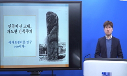
After the 390s, Koguryo seized the Yaeseong-gang and Imjin-gang river areas and then advanced its troops to the Baekje capital city, yet was met with resistance and had to retreat to the Imjin-gang area. So, in the early days of the 5th century, the borderline between the two dynasties actually moved to the Imjin-gang/Han-gang watershed point, and Koguryo seized the source of the Bukhan-gang river in the Yeongseo region. Interestingly enough, the Gwang’gaeto-wang Stele recorded the maximum range of Koguryo’s campaign, yet in Samguk Sagi which shows us the records created by Baekje does not recognize such fact that Koguryo attacked its own capital.
We can see that the borderline between Koguryo and Baekje changed considerably by the Koguryo king Gwang’gaeto-wang’s campaigns in the south. But the two dynasties did not have a clear line between them, and only the watershed point or river basin indicated their territories. This should be kept in mind in determining the format of the ancient borderlines in Korea, and the ancient people’s view of their own territories.
After the 390s, Koguryo seized the Yaeseong-gang and Imjin-gang river areas and then advanced its troops to the Baekje capital city, yet was met with resistance and had to retreat to the Imjin-gang area. So, in the early days of the 5th century, the borderline between the two dynasties actually moved to the Imjin-gang/Han-gang watershed point, and Koguryo seized the source of the Bukhan-gang river in the Yeongseo region. Interestingly enough, the Gwang’gaeto-wang Stele recorded the maximum range of Koguryo’s campaign, yet in Samguk Sagi which shows us the records created by Baekje does not recognize such fact that Koguryo attacked its own capital.
We can see that the borderline between Koguryo and Baekje changed considerably by the Koguryo king Gwang’gaeto-wang’s campaigns in the south. But the two dynasties did not have a clear line between them, and only the watershed point or river basin indicated their territories. This should be kept in mind in determining the format of the ancient borderlines in Korea, and the ancient people’s view of their own territories.
Examined in this article is how the borderline between Koguryo and Baekje changed during the latter half of the 4th century and the early days of the 5th. Examination shows us that both dynasties competed with each other during the 370s and the 380s, and in the end eventually came in contact physically with each other. Initially, the Myeol’ak mountain range, which also served as the watershed point between the Jae’ryeong-gang and Yeseong-gang rivers, served as the borderline between them. In the meantime, inside the northeast area of Baekje, a frontline was formed in the Pyeong’gang/平康area which was located in the upper region of the Imjin-gang river. Ye(穢), which had been subjugated by Koguryo, was in conflict the Baekje forces, on behalf of the Koguryo forces.
After the 390s, Koguryo seized the Yaeseong-gang and Imjin-gang river areas and then advanced its troops to the Baekje capital city, yet was met with resistance and had to retreat to the Imjin-gang area. So, in the early days of the 5th century, the borderline between the two dynasties actually moved to the Imjin-gang/Han-gang watershed point, and Koguryo seized the source of the Bukhan-gang river in the Yeongseo region. Interestingly enough, the Gwang’gaeto-wang Stele recorded the maximum range of Koguryo’s campaign, yet in Samguk Sagi which shows us the records created by Baekje does not recognize such fact that Koguryo attacked its own capital.
We can see that the borderline between Koguryo and Baekje changed considerably by the Koguryo king Gwang’gaeto-wang’s campaigns in the south. But the two dynasties did not have a clear line between them, and only the watershed point or river basin indicated their territories. This should be kept in mind in determining the format of the ancient borderlines in Korea, and the ancient people’s view of their own territories.
목차 (Table of Contents)
- 머리말
- 1. 370~380년대 고구려?백제의 각축전과 접경지역 형성
- 2. 광개토왕대 고구려와 백제의 전쟁에 관한 사료 검토
- 3. 5세기 초엽 고구려?백제의 국경 변화
- 맺음말
- 머리말
- 1. 370~380년대 고구려?백제의 각축전과 접경지역 형성
- 2. 광개토왕대 고구려와 백제의 전쟁에 관한 사료 검토
- 3. 5세기 초엽 고구려?백제의 국경 변화
- 맺음말
- 참고문헌
- 〈Abstract〉
참고문헌 (Reference)
1 도수희, "한국의 지명" 아카넷 2003
2 이병도, "한국고대사연구" 박영사 1975
3 김영진, "한국 고대어의 ‘買’에 대하여" 14 : 1985
4 성주탁, "한강유역 백제초기 성지 연구" 14 : 1984
5 중원문화재연구소, "충주탑평리유적 시굴조사보고서" 2009
6 중원문화재연구소, "충주 탑평리유적 발굴조사 현장설명회 자료"
7 변태섭, "중원고구려비의 내용과 연대에 대한 검토" 13 : 1979
8 손영종, "중원고구려비에 대하여" 2 : 1985
9 서영일, "중원고구려비에 나타난 고구려 성과 관방체계" 10 : 2000
10 명지대학교 부설 한국건축문화연구소, "아차산성 기초 학술조사보고서" 1998
1 도수희, "한국의 지명" 아카넷 2003
2 이병도, "한국고대사연구" 박영사 1975
3 김영진, "한국 고대어의 ‘買’에 대하여" 14 : 1985
4 성주탁, "한강유역 백제초기 성지 연구" 14 : 1984
5 중원문화재연구소, "충주탑평리유적 시굴조사보고서" 2009
6 중원문화재연구소, "충주 탑평리유적 발굴조사 현장설명회 자료"
7 변태섭, "중원고구려비의 내용과 연대에 대한 검토" 13 : 1979
8 손영종, "중원고구려비에 대하여" 2 : 1985
9 서영일, "중원고구려비에 나타난 고구려 성과 관방체계" 10 : 2000
10 명지대학교 부설 한국건축문화연구소, "아차산성 기초 학술조사보고서" 1998
11 천관우, "삼한의 국가형성" 3 : 1976
12 정광, "삼국시대 한반도의 언어연구" 박문사 2011
13 김기섭, "삼국사기 ‘백제본기’에 보이는 靺鞨과 樂浪의 위치에 대한 재검토" 8 : 1991
14 노중국, "백제정치사연구" 일조각 1988
15 문안식, "백제의 흥망과 전쟁" 혜안 2006
16 李基東, "백제사연구" 일조각 1996
17 이도학, "백제 관미성에 관한 일고" 19·20 : 1990
18 李漢祥, "동해안 지역의 5~6세기대 신라분묘 확산양상" 32 : 2003
19 서영교, "나당전쟁사연구" 아세아문화사 2006
20 박성봉, "광개토호태왕조 고구려 남진의 성격" 27 : 1979
21 李仁哲, "광개토호태왕비를 통해 본 고구려의 남방경영" 2 : 1996
22 김윤우, "광개토왕의 南下征服地에 대한 一考" 용암차문섭교수화갑기념사학논총 1989
23 연민수, "광개토왕비문에 보이는 倭關係 기사의 검토" 21 : 1987
24 손영종, "광개토왕릉비를 통하여본 고구려의 영역" 2 : 1986
25 노태돈, "광개토왕릉비, In 역주 한국고대금석문(I)" 가락국사적개발연구원 1992
26 박시형, "광개토왕릉비" 사회과학원 1966
27 이형구, "광개토대왕릉비신연구(제2판)" 동화출판사 1996
28 윤일녕, "관미성위치고" 2 : 1990
29 정요근, "고려 중.후기 '임진도로(臨津渡路)'의 부상(浮上)과 그 영향" 한국역사연구회 59 (59): 197-227, 2006
30 김영황, "고구려의 언어유산" 김일성종합대학 출판부 2010
31 서영일, "고구려의 백제공격로 고찰" 38 : 2006
32 장국종, "고구려에서의 도로발전" 2 : 1985
33 손영종, "고구려사(1)" 과학백과사전종합출판사 1990
34 윤명철, "고구려 해양사연구" 사계절 2003
35 금경숙, "고구려 영역으로서의 북한강 유역" 11 : 2001
36 임기환, "고구려 신라의 한강 유역 경영과 서울" 서울학연구소 (18) : 1-33, 2002
37 이도학, "고구려 광개토왕릉비문 연구" 서경문화사 2006
38 권인한, "개정판 중세한국한자음훈집성" 제이앤씨 2008
39 최종택, "黃州出土百濟土器例" 4 : 1990
40 管政友, "高麗好太王碑銘考" 2 (2): 1891
41 池內宏, "高句麗滅亡後遺民叛亂及唐新羅關係" 12 : 1927
42 武田幸男, "高句麗史と東アジア史" 岩波書店 1989
43 那珂通世, "高句麗古碑考" 49 : 1893
44 정구복, "譯註 三國史記(1~5)" 한국정신문화연구원 1997
45 김영심, "百濟의 城, 村과 地方統治" 28 : 1998
46 도수희, "百濟語 語彙 硏究" 제이엔씨 2005
47 양기석, "百濟史資料譯註集(韓國篇I)" 충남남도 역사문화연구원 2008
48 津田左右吉, "朝鮮歷史地理 (제1권)" 南滿洲鐵道株式會社 1913
49 김정숙, "晉率善穢佰長銅印, In 譯註 韓國古代金石文 II" 한국고대사회연구소 1992
50 酒井改藏, "好太王碑面の地名について" 8 : 1955
51 耿鐵華, "好太王碑新考" 吉林人民出版社 1994
52 津田左右吉, "三國史記高句麗本紀の批判, In 津田左右吉全集 12" 岩波書店 1964
53 三品彰英, "三國史記高句麗本紀の原典批判" 6 : 1953
54 유원재, "三國史記 僞靺鞨考" 29 : 1979
55 佐伯有淸, "七支刀と廣開土王碑" 吉川弘文館 1977
56 홍영호, "『三國史記』 所載 泥河의 위치 비정" 한국사연구회 (150) : 43-83, 2010
57 여호규, "<광개토왕릉비>에 나타난 고구려의 대중인식(對中認識)과 대외정책" 한국역사연구회 (55) : 25-60, 2005
58 여호규, "<廣開土王陵碑>에 나타난 高句麗 天下의 공간범위와 주변 族屬에 대한 인식" 역사문화연구소 (32) : 3-48, 2009
59 박성현, "6세기 초 고구려 ` 신라의 화약과 정계 -「중원 고구려비」와 양국 경계의 재검토 -" 한국역사연구회 (76) : 203-237, 2010
60 노태돈, "5~7세기 고구려 지방제도" 8 : 1996
61 최창빈, "4세기 말~5세기 초 고구려의 국남7성과 국동6성에 대하여" 3 : 1990
62 여호규, "4세기 동북아 국제정세와 고구려 고국원왕의 생애" 역사문화연구소 (20) : 1-37, 2004
63 成正鏞, "4~5세기 百濟의 地方支配" 24 : 2001
동일학술지(권/호) 다른 논문
-
- 한국역사연구회
- 임용한(서평자)
- 2012
- KCI등재
-
- 한국역사연구회
- 남동신
- 2012
- KCI등재
-
- 한국역사연구회
- 박종기(Park, Jong-ki)
- 2012
- KCI등재
-
- 한국역사연구회
- 김인호(Kim, In-ho)
- 2012
- KCI등재
분석정보
인용정보 인용지수 설명보기
학술지 이력
| 연월일 | 이력구분 | 이력상세 | 등재구분 |
|---|---|---|---|
| 2026 | 평가 | 재인증평가 신청대상 (재인증) | |
| 2020-01-01 | 등재 | 등재학술지 유지 (재인증) | |
| 2017-01-01 | 등재 | 등재학술지 유지 (계속평가) | |
| 2013-01-01 | 등재 | 등재학술지 유지 (등재유지) | |
| 2010-01-01 | 등재 | 등재학술지 유지 (등재유지) | |
| 2008-01-01 | 등재 | 등재학술지 유지 (등재유지) | |
| 2006-01-01 | 등재 | 등재학술지 유지 (등재유지) | |
| 2005-10-05 | 학술지명변경 | 한글명 : 역사와 현실 -> 역사와 현실외국어명 : 미등록 -> YŎKSA WA HYŎNSIL | |
| 2004-01-01 | 등재 | 등재학술지 유지 (등재유지) | |
| 2001-01-01 | 등재 | 등재학술지 선정 (등재후보2차) | |
| 1998-07-01 | 등재 | 등재후보학술지 선정 (신규평가) |  |
학술지 인용정보
| 기준연도 | WOS-KCI 통합IF(2년) | KCIF(2년) | KCIF(3년) |
|---|---|---|---|
| 2016 | 0.91 | 0.91 | 0.87 |
| KCIF(4년) | KCIF(5년) | 중심성지수(3년) | 즉시성지수 |
| 0.87 | 0.92 | 1.68 | 0.36 |



이 자료와 함께 이용한 RISS 자료
나만을 위한 추천자료
로그인하고 관련된 다양한 학술자료를 확인해 보세요.
로그인

