 국립중앙도서관 "우편 복사 서비스"로 연결 됩니다.


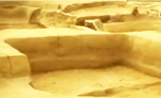
본 연구는 백제의 방어체계를 이해하기 위해 금강 중류역(공주, 대전, 세종, 청주)에 위치한 백제 석축산성의 공간적 분포와 특징을 분석하였다. 연구 대상은 해당 지역에 위치한 124개소 산...
다국어 입력
あ
ぁ
か
が
さ
ざ
た
だ
な
は
ば
ぱ
ま
や
ゃ
ら
わ
ゎ
ん
い
ぃ
き
ぎ
し
じ
ち
ぢ
に
ひ
び
ぴ
み
り
う
ぅ
く
ぐ
す
ず
つ
づ
っ
ぬ
ふ
ぶ
ぷ
む
ゆ
ゅ
る
え
ぇ
け
げ
せ
ぜ
て
で
ね
へ
べ
ぺ
め
れ
お
ぉ
こ
ご
そ
ぞ
と
ど
の
ほ
ぼ
ぽ
も
よ
ょ
ろ
を
ア
ァ
カ
サ
ザ
タ
ダ
ナ
ハ
バ
パ
マ
ヤ
ャ
ラ
ワ
ヮ
ン
イ
ィ
キ
ギ
シ
ジ
チ
ヂ
ニ
ヒ
ビ
ピ
ミ
リ
ウ
ゥ
ク
グ
ス
ズ
ツ
ヅ
ッ
ヌ
フ
ブ
プ
ム
ユ
ュ
ル
エ
ェ
ケ
ゲ
セ
ゼ
テ
デ
ヘ
ベ
ペ
メ
レ
オ
ォ
コ
ゴ
ソ
ゾ
ト
ド
ノ
ホ
ボ
ポ
モ
ヨ
ョ
ロ
ヲ
―
http://chineseinput.net/에서 pinyin(병음)방식으로 중국어를 변환할 수 있습니다.
변환된 중국어를 복사하여 사용하시면 됩니다.
예시)
- 中文 을 입력하시려면 zhongwen을 입력하시고 space를누르시면됩니다.
- 北京 을 입력하시려면 beijing을 입력하시고 space를 누르시면 됩니다.
А
Б
В
Г
Д
Е
Ё
Ж
З
И
Й
К
Л
М
Н
О
П
Р
С
Т
У
Ф
Х
Ц
Ч
Ш
Щ
Ъ
Ы
Ь
Э
Ю
Я
а
б
в
г
д
е
ё
ж
з
и
й
к
л
м
н
о
п
р
с
т
у
ф
х
ц
ч
ш
щ
ъ
ы
ь
э
ю
я
′
″
℃
Å
¢
£
¥
¤
℉
‰
$
%
F
₩
㎕
㎖
㎗
ℓ
㎘
㏄
㎣
㎤
㎥
㎦
㎙
㎚
㎛
㎜
㎝
㎞
㎟
㎠
㎡
㎢
㏊
㎍
㎎
㎏
㏏
㎈
㎉
㏈
㎧
㎨
㎰
㎱
㎲
㎳
㎴
㎵
㎶
㎷
㎸
㎹
㎀
㎁
㎂
㎃
㎄
㎺
㎻
㎽
㎾
㎿
㎐
㎑
㎒
㎓
㎔
Ω
㏀
㏁
㎊
㎋
㎌
㏖
㏅
㎭
㎮
㎯
㏛
㎩
㎪
㎫
㎬
㏝
㏐
㏓
㏃
㏉
㏜
㏆

RISS 인기검색어
백제 석축산성의 공간분포 연구 : 금강 중류역을 중심으로 = A Study on the Spatial Distribution of Baekje Stone Fortresses
한글로보기부가정보
국문 초록 (Abstract)

본 연구는 백제의 방어체계를 이해하기 위해 금강 중류역(공주, 대전, 세종, 청주)에 위치한 백제 석축산성의 공간적 분포와 특징을 분석하였다. 연구 대상은 해당 지역에 위치한 124개소 산성 중 석축산성으로 확인된 57개소를 선정하였으며, 발굴조사 및 지표조사에서 확인된 자료를 기반으로 ArcGIS pro, PostgreSQL을 활용하여 공간분포와 방어체계를 조명하였다. 이를 통해 금강 중류역 백제 석축산성의 역할과 특징을 파악하는 것을 목적으로 하였다.
우선, 커널밀도분석(Kernel Density)을 통해 금강 중류역의 백제 석축산성은 세종 전의면 및 부강면, 대전 대덕구, 동구, 유성구에 분포하고 있음이 확인되었다. 이어 K-means 군집분석을 적용하여 산성의 분포를 4.7km 및 20km 단위로 군집화 한 결과, 각각 10개와 25개의 군집이 도출되었다. 커널밀도분석을 통해 전체적인 분포 경향을 시각적으로 파악한 후, 산성들을 거리 기반으로 군집화하여 공간적 분포를 정량적으로 정리할 수 있었다. 특히, 20km 단위에서 10개의 군집은 백제의 추정 군현 단위와 유사한 경향을 보였다. 또한 군집화 과정에서 나타나는 이상점(Outliers)을 통해 당시의 군사적, 정치적, 지리적 필요에 따라 개별적 특수 역할을 수행 했을 가능성이 있다.
권역별 감시권분석(Viewshed Analysis)을 통해 각 산성이 특정 지역과 주요 교통로를 감시하는 기능을 수행했음을 확인하였다. 분석 결과, 산성의 분포는 금강 및 주요 교통로와 밀접한 연관성을 보였으며, 이는 방어체계 강화와 지방통치의 중요성을 고려한 전략적 입지로 해석된다.
다음으로 백제 석축산성의 구조적 특성과 축조 방법을 중심으로 공간분석 결과와 기존 연구를 함께 고찰한 결과, 웅진기에는 주로 편축식 축조기법이, 사비기로 넘어가며 협축식 기법이 활용되는 등 축성 방식의 변화가 나타났다. 이는 백제의 통치체제가 강화됨에 따라 1차적으로 행정적 필요에 따라 규모가 큰 치소성을 조성한 후, 군사적 요구로 인해 2차적으로 규모가 작은 석축산성으로 조성되었음을 보여준다. 산성의 규모와 분포를 고려할 때, 금강 중류역의 석축산성들은 웅진으로 향하는 길목을 방어하는 1차 방어선과 국경 방어를 위한 군집간 연계를 통한 2차 방어선으로 이중 방어체계를 이루고 있었던 것으로 이해하였다.
디지털 분석 도구를 활용하여 기초자료의 부족으로 인해 제한되었던 연구 대상의 범위를 확장하였으며, 시간적 특성을 반영한 고고자료와 문헌 사료의 추가 비교를 통해 보다 구체적인 이해가 이루어질 수 있을 것이다.
본 연구는 백제의 방어체계를 이해하기 위해 금강 중류역(공주, 대전, 세종, 청주)에 위치한 백제 석축산성의 공간적 분포와 특징을 분석하였다. 연구 대상은 해당 지역에 위치한 124개소 산성 중 석축산성으로 확인된 57개소를 선정하였으며, 발굴조사 및 지표조사에서 확인된 자료를 기반으로 ArcGIS pro, PostgreSQL을 활용하여 공간분포와 방어체계를 조명하였다. 이를 통해 금강 중류역 백제 석축산성의 역할과 특징을 파악하는 것을 목적으로 하였다.
우선, 커널밀도분석(Kernel Density)을 통해 금강 중류역의 백제 석축산성은 세종 전의면 및 부강면, 대전 대덕구, 동구, 유성구에 분포하고 있음이 확인되었다. 이어 K-means 군집분석을 적용하여 산성의 분포를 4.7km 및 20km 단위로 군집화 한 결과, 각각 10개와 25개의 군집이 도출되었다. 커널밀도분석을 통해 전체적인 분포 경향을 시각적으로 파악한 후, 산성들을 거리 기반으로 군집화하여 공간적 분포를 정량적으로 정리할 수 있었다. 특히, 20km 단위에서 10개의 군집은 백제의 추정 군현 단위와 유사한 경향을 보였다. 또한 군집화 과정에서 나타나는 이상점(Outliers)을 통해 당시의 군사적, 정치적, 지리적 필요에 따라 개별적 특수 역할을 수행 했을 가능성이 있다.
권역별 감시권분석(Viewshed Analysis)을 통해 각 산성이 특정 지역과 주요 교통로를 감시하는 기능을 수행했음을 확인하였다. 분석 결과, 산성의 분포는 금강 및 주요 교통로와 밀접한 연관성을 보였으며, 이는 방어체계 강화와 지방통치의 중요성을 고려한 전략적 입지로 해석된다.
다음으로 백제 석축산성의 구조적 특성과 축조 방법을 중심으로 공간분석 결과와 기존 연구를 함께 고찰한 결과, 웅진기에는 주로 편축식 축조기법이, 사비기로 넘어가며 협축식 기법이 활용되는 등 축성 방식의 변화가 나타났다. 이는 백제의 통치체제가 강화됨에 따라 1차적으로 행정적 필요에 따라 규모가 큰 치소성을 조성한 후, 군사적 요구로 인해 2차적으로 규모가 작은 석축산성으로 조성되었음을 보여준다. 산성의 규모와 분포를 고려할 때, 금강 중류역의 석축산성들은 웅진으로 향하는 길목을 방어하는 1차 방어선과 국경 방어를 위한 군집간 연계를 통한 2차 방어선으로 이중 방어체계를 이루고 있었던 것으로 이해하였다.
디지털 분석 도구를 활용하여 기초자료의 부족으로 인해 제한되었던 연구 대상의 범위를 확장하였으며, 시간적 특성을 반영한 고고자료와 문헌 사료의 추가 비교를 통해 보다 구체적인 이해가 이루어질 수 있을 것이다.
다국어 초록 (Multilingual Abstract)
This study analyzed the spatial distribution and characteristics of Baekje stone fortresses located in the middle reaches of the Geumgang River (Gongju, Daejeon, Sejong, and Cheongju) to understand the defense system of Baekje. The study focused on 57 stone fortresses among 124 fortresses in the region, selected based on excavation and surface survey data. Using ArcGIS Pro and PostgreSQL, spatial distribution and defense systems were examined. The aim was to identify the role and characteristics of the Baekje stonefortresses in the middle reaches of the Geumgang River.
First, Kernel Density Analysis confirmed that the Baekje stone fortresses in the middle Geumgang River region are distributed in Jeonui-myeon and Bugang-myeon in Sejong, and in Daedeok-gu, Dong-gu, and Yuseong-gu in Daejeon. Next, K-means cluster analysis was applied to group the distribution of the fortresses at intervals of 4.7 km and 20 km, resulting in 10 and 25 clusters, respectively. After visually analyzing the overall distribution trend through Kernel Density Analysis, the fortresses were grouped by distance, allowing for a quantitative arrangement of their spatial distribution. Notably, at the 20 km interval, 10 clusters exhibited a pattern similar to the presumed administrative districts of Baekje. Additionally, outliers identified in the clustering process suggested that the fortresses may have performed specialized roles according to the military, political, and geographical needs of the time.
Viewshed analysis for each region confirmed that the fortresses played a role in monitoring specific areas and major transportation routes. The analysis revealed that the distribution of the fortresses is closely related to the Geumgang River and major transport routes, suggesting a strategic location aimed at strengthening the defense system and enhancing the importance of local governance.
Next, by examining the structural characteristics and construction methods of Baekje stone fortresses in conjunction with spatial analysis results and existing research, a change in construction techniques was observed as Baekje transitioned from the Ungjin period to the Sabi period. This shift indicates that, as Baekje's governance system strengthened, large administrative centers were initially established for administrative purposes, followed by smaller stonefortresses built to meet military demands. Considering the scale and distribution of the fortresses, it is understood that the stonefortresses in the middle reaches of the Geumgang River formed a dual defense system: a primary defense line guarding the approach to Ungjin and a secondary defense line connected between fortresses for border defense.
By utilizing digital analysis tools, the study expanded the scope of the research, which had been limited due to a lack of foundational data. Furthermore, a more detailed understanding can be achieved through the additional comparison of archaeological data and historical records that reflect the temporal characteristics.
This study analyzed the spatial distribution and characteristics of Baekje stone fortresses located in the middle reaches of the Geumgang River (Gongju, Daejeon, Sejong, and Cheongju) to understand the defense system of Baekje. The study focused on 57...
This study analyzed the spatial distribution and characteristics of Baekje stone fortresses located in the middle reaches of the Geumgang River (Gongju, Daejeon, Sejong, and Cheongju) to understand the defense system of Baekje. The study focused on 57 stone fortresses among 124 fortresses in the region, selected based on excavation and surface survey data. Using ArcGIS Pro and PostgreSQL, spatial distribution and defense systems were examined. The aim was to identify the role and characteristics of the Baekje stonefortresses in the middle reaches of the Geumgang River.
First, Kernel Density Analysis confirmed that the Baekje stone fortresses in the middle Geumgang River region are distributed in Jeonui-myeon and Bugang-myeon in Sejong, and in Daedeok-gu, Dong-gu, and Yuseong-gu in Daejeon. Next, K-means cluster analysis was applied to group the distribution of the fortresses at intervals of 4.7 km and 20 km, resulting in 10 and 25 clusters, respectively. After visually analyzing the overall distribution trend through Kernel Density Analysis, the fortresses were grouped by distance, allowing for a quantitative arrangement of their spatial distribution. Notably, at the 20 km interval, 10 clusters exhibited a pattern similar to the presumed administrative districts of Baekje. Additionally, outliers identified in the clustering process suggested that the fortresses may have performed specialized roles according to the military, political, and geographical needs of the time.
Viewshed analysis for each region confirmed that the fortresses played a role in monitoring specific areas and major transportation routes. The analysis revealed that the distribution of the fortresses is closely related to the Geumgang River and major transport routes, suggesting a strategic location aimed at strengthening the defense system and enhancing the importance of local governance.
Next, by examining the structural characteristics and construction methods of Baekje stone fortresses in conjunction with spatial analysis results and existing research, a change in construction techniques was observed as Baekje transitioned from the Ungjin period to the Sabi period. This shift indicates that, as Baekje's governance system strengthened, large administrative centers were initially established for administrative purposes, followed by smaller stonefortresses built to meet military demands. Considering the scale and distribution of the fortresses, it is understood that the stonefortresses in the middle reaches of the Geumgang River formed a dual defense system: a primary defense line guarding the approach to Ungjin and a secondary defense line connected between fortresses for border defense.
By utilizing digital analysis tools, the study expanded the scope of the research, which had been limited due to a lack of foundational data. Furthermore, a more detailed understanding can be achieved through the additional comparison of archaeological data and historical records that reflect the temporal characteristics.
목차 (Table of Contents)
- Ⅰ. 서론 1
- 1. 선행 연구 검토 및 문제 제기 2
- 2. 연구 대상 및 연구 방법 9
- II. 금강 중류역 백제 석축산성 현황 13
- 1. 금강 중류역 백제 석축산성 분포 13
- Ⅰ. 서론 1
- 1. 선행 연구 검토 및 문제 제기 2
- 2. 연구 대상 및 연구 방법 9
- II. 금강 중류역 백제 석축산성 현황 13
- 1. 금강 중류역 백제 석축산성 분포 13
- 2. 공주지역 13
- 3. 대전지역 18
- 4. 세종지역 56
- Ⅲ. 공간분석을 통해 본 금강 중류역 백제 석축산성 64
- 1. 군집분석을 통해 분포 권역 설정 64
- 2. 권역별 감시권분석 74
- Ⅳ. 금강 중류역 백제 석축산성의 공간분포 분석과 특징 99
- 1. 금강 중류역 백제 석축산성의 공간분포 분석 99
- 2. 금강 중류역 백제 석축산성의 공간적 특징 108
- Ⅴ. 결론 111
- 참고문헌 113
분석정보


이 자료와 함께 이용한 RISS 자료
나만을 위한 추천자료


